Trail Walking Les Adrets - Un Tour du Crêt de Chazay - Photo

Un Tour du Crêt de Chazay

 patjobou
patjobou

User

© OpenStreetMap contributors
Length
Length
7.8 km
Max alt
Max alt
906 m
Uphill gradient
Uphill gradient
333 m
Km-Effort
Km-Effort  
12.2 km
Min alt
Min alt
632 m
Downhill gradient
Downhill gradient
325 m
Boucle
Boucle
Yes
Creation date :
2022-02-22 14:25:52.126
Updated on :
2022-02-22 14:33:30.31

(1 Reviews)

Walking
Walking
2h46
Difficulty : Easy

Scan this QR Code to open this trail in the SityTrail application

FREE GPS app for hiking

Logo SityTrail SityTrail

IGN / Geographical institutes

Download SityTrail from the App Store Download SityTrail from Google Play

Logo SityTrail SityTrail World

The world is yours!

Download SityTrail from the App Store Download SityTrail from Google Play Download SityTrail on Huawei AppGallery

About

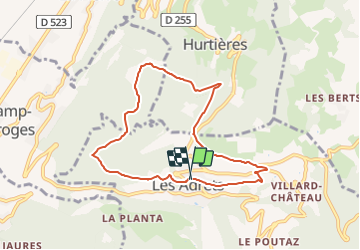
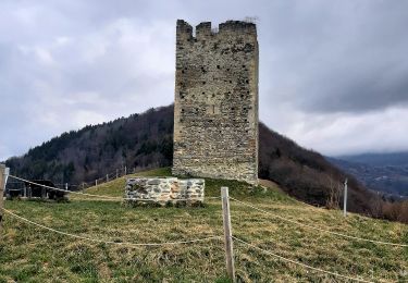
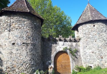
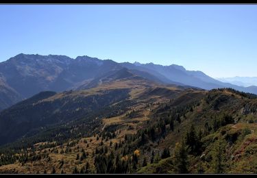
Trail Walking of 7.8 km to be discovered at Auvergne-Rhône-Alpes, Isère, Les Adrets. This trail is proposed by patjobou.

Description

Tracé à l'écran.
Du Col (872m), on peut aussi rentrer par les Granges du Chazay.

Elevation profile

Positioning

Country:
France
Region :
Auvergne-Rhône-Alpes
Department/Province :
Isère
Municipality :
Les Adrets
Location:
Unknown
Start:(UTM)
732546 ; 5017406 (31T) N.

Comments

Please log in to post a review or rate the element


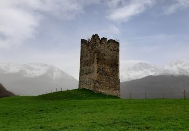
Magnifique randonnée, à éviter les jours de pluie 👍


Trails nearby

Trail Walking Les Adrets - les 7 laux - Photo
Walking
Didou2626

Walking

Medium
(1)
Les Adrets, Auvergne-Rhône-Alpes, Isère, France
12.4 km | 21 km-effort
4h 23min
Yes
Trail Mountain bike Theys - Autour du crêt de Chazay - Photo
Mountain bike
gilder89

Mountain bike

Medium
(1)
Theys, Auvergne-Rhône-Alpes, Isère, France
15.7 km | 23 km-effort
2h 30min
Yes
Trail Walking Laval-en-Belledonne - Boucle Laval - Sainte-Agnès - Photo
Walking
flip38

Walking

Medium
Laval-en-Belledonne, Auvergne-Rhône-Alpes, Isère, France
17.7 km | 29 km-effort
4h 28min
Yes
Trail Walking Theys - Col du Merdaret, Roche Noire au départ de Pipay  - Photo
Walking
Zasa

Walking

Easy
Theys, Auvergne-Rhône-Alpes, Isère, France
14.2 km | 24 km-effort
4h 15min
Yes
Trail Walking Theys - TOUR DE LA GRANGE DE BELLE AUX AIRS - Photo
Walking
walrou63

Walking

Medium
Theys, Auvergne-Rhône-Alpes, Isère, France
6.8 km | 10.1 km-effort
1h 40min
Yes
Trail Walking Froges - Froges-Montfallet-Champ près Froges - Photo
Walking
flip38

Walking

Medium
Froges, Auvergne-Rhône-Alpes, Isère, France
13.5 km | 22 km-effort
3h 41min
Yes
Trail Walking Laval-en-Belledonne - Tour du vallon de Laval - Photo
Walking
Emelle

Walking

Medium
Laval-en-Belledonne, Auvergne-Rhône-Alpes, Isère, France
13.5 km | 21 km-effort
4h 38min
Yes
Trail Walking Theys - Grand Rocher - Photo
Walking
flip38

Walking

Medium
Theys, Auvergne-Rhône-Alpes, Isère, France
15.2 km | 24 km-effort
4h 40min
Yes
Trail On foot Theys - Sept laux Lac blanc Col du buisson - Photo
On foot
yann07

On foot

Very difficult
Theys, Auvergne-Rhône-Alpes, Isère, France
29 km | 59 km-effort
13h 19min
Yes


Close
My subscriptions